


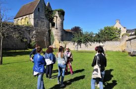


This tour allows you to discover 6 armoured bollardsThe map, with 4 different coats of arms, marks the boundary of the Bois de Fosses, which belonged to Constable Anne de Montmorency and was demarcated by him in 1540. You can also see 3 of the posts of the Halatte forest since the 18th century.
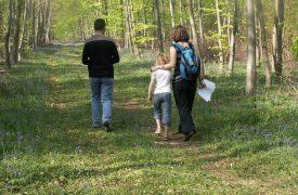
- Departure : car park at the Queue de la Brosse crossroads on the road from Aumont-en-Halatte to Senlis through the forest, 300m after the Aumont-en-Halatte exit sign.
- Duration : 1h30mn
- Distance : 3.2km
- Difference in altitude : almost flat
- Nature of the roads : 70% tarred or passable road - 30% dirt track - including 100m muddy in wet weather around the Courcolet pole
- Difficulty : No walking difficulties, except perhaps in muddy areas.
- Points of interest : 6 armoured bollards and 3 posts
Route details
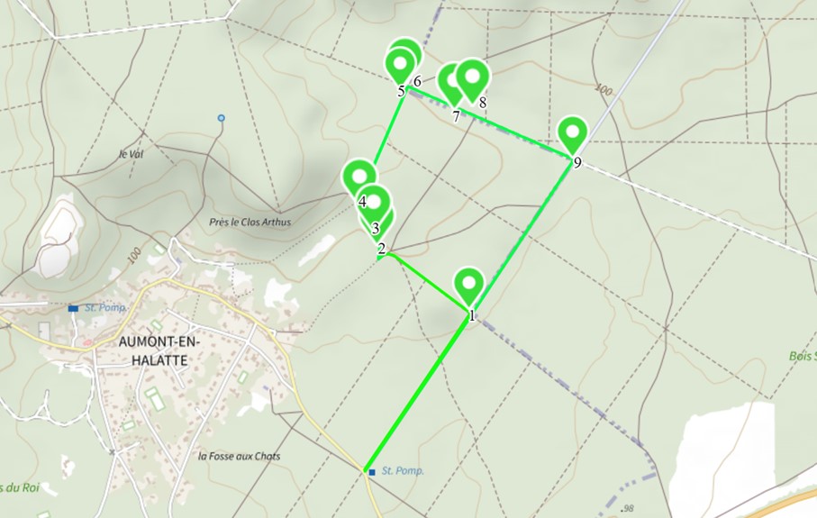
Take the Queue de la Brosse road north-eastwards to the Tombray crossroads at 600m.
1-Poteau du Tombray
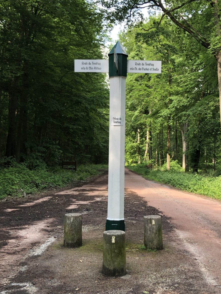
The Queue de la Brosse road is one of the "new roads made by royal order in the 17th century, long and straight "for the convenience of hunting. It appeared on maps as early as 1695. It linked the priory of Saint Christophe in the north to the locality of Queue de la Brosse in the south. "Tail" refers to an elongated wooded area, and "brush" to scrub or coppice. In the past, most of the Halatte forest was covered in coppice.
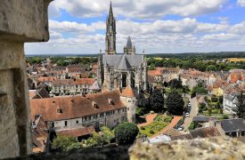
The Tombray crossroadsThe village, at the intersection of the route de la Queue de la Brosse and the route du Tombray, dates from the 18th century and appears on Delavigne's map of 1724. The origin of the name of this locality is thought to come from tombelle, an earthen or stone mound raised above graves.The site is believed to be a Neolithic burial mound north of Senlis, but no trace of it has survived.
Turn left at 90° onto Route du Tombray. Continue 350m to the wall of a private property and head towards the corner of the wall, slightly to the left. The first marker on the route is along the wall, close to the corner.
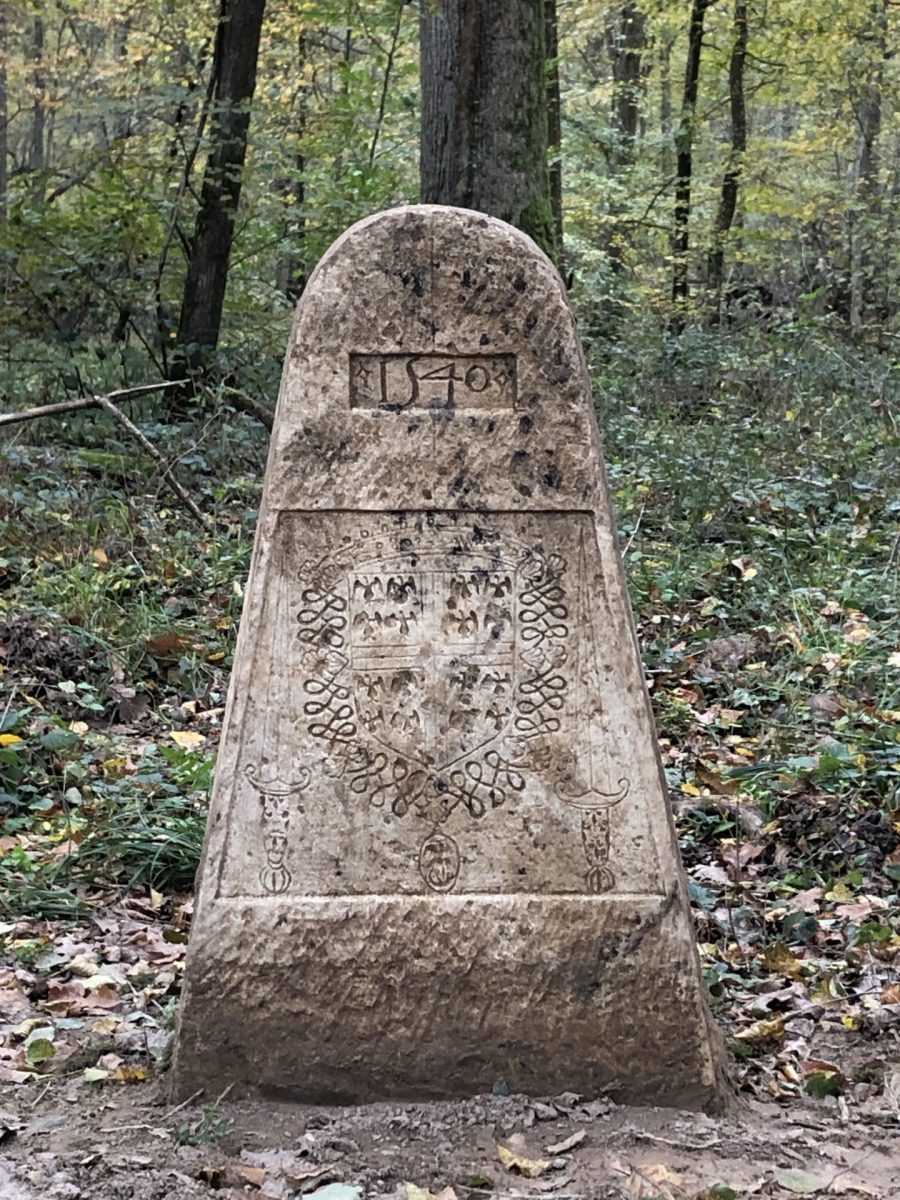
2-4-sided escutcheon with 3 coats of arms
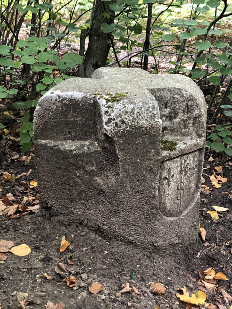
This terminal is at the junction of 4 plotsas shown by the relief on the top of the bollard. The The owners' coats of arms face their plots.
To the north-west, of Constable Anne de Montmorency, the Bois de Fosses.
To the east, recognisable by the Templar crossthe Laigneville Commanderythe former Commandery of the Temple. To the south, the bishopric of Senlis is identified by the S for Senlis, surrounded by two fleurs-de-lys (royal city) and crossed vertically by the bishop's crozier.
In the case of the parcel to the south-west, there are no marks on the face of the boundary marker, as this is not a piece of woodland, but the territory of the municipality of Aumont-en Halatte.
The date of installation of these terminals, 1540is engraved on the front of the Laigneville commandery.
Return to the path and follow the wall north for 50m. The second marker is along the wall.
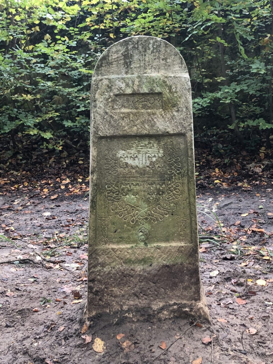
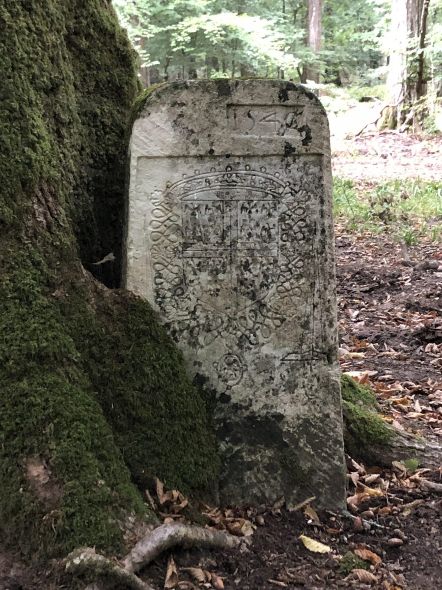
3-Borne armorial 2 faces, a single coat of arms
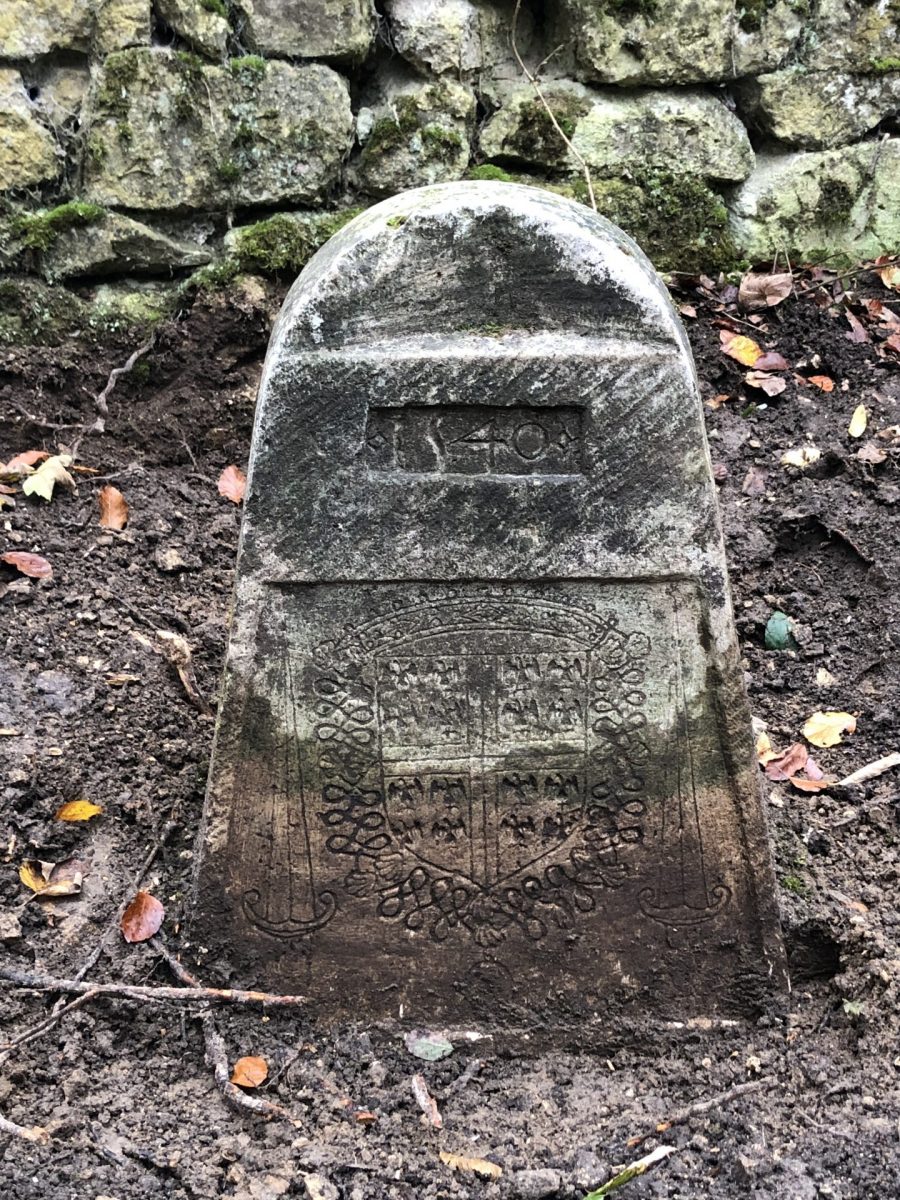
the top relief of the bollard design the boundary of the plot which faces north at an angle of 30°.
The side along the road bears the date 1540 and the coat of arms of Constable Anne de Montmorency : dans l’écu un écartelé de 4 fois 4 alérions (petits aigles utilisés en héraldique) commémorant des victoires des Montmorency ; au-dessus de l’écu, un tortil, la couronne de baron, titre d’Anne de Montmorency en 1540 ; autour de l’écu, le collier de l’ordre de Saint-Michel, coquilles entrelacées avec, en médaillon, l’Archange Saint Michel terrassant le dragon.
Finally, on either side of the shield, the sword of the Constable of France, recognisable by the fleurs-de-lys on the pommel.
Anne de Montmorency was appointed Constable of France by François I in 1538.. The highest distinction in the kingdom, the constable represents the king and carries his sword.
Return to the path and follow the wall northwards for 80m. The third milestone is along the path, on the right.
4-Borne armorial 2 faces, a single coat of arms
Cette borne est différente de la précédente, plus haute et plus droite. Plusieurs ateliers ont travaillé à la réalisation de ces bornes pour satisfaire une demande importante sur une période de temps courte.
Elle présente sur la face à l’opposé du chemin la date de 1540 et les armoiries du connétable Anne de Montmorency. Sur l’autre face, l’écusson vide n’a jamais été gravé, puisqu’il s’agit, non pas d’une parcelle forestière, mais du territoire de la commune d’Aumont-en-Halatte.
This bollard was badly leaning and was part of the campaign to straighten the armorial posts carried out in November 2023, thanks to the Senlis Society of History and Archaeology and the financial support of the Senlis Rotary Club, which enabled it to be seen today in its original position.
When you reach the corner of the wall, at the crossroads, turn right onto the Route d'Auteuil, heading north-east, and continue as far as the Courcolet crossroads at 380m.
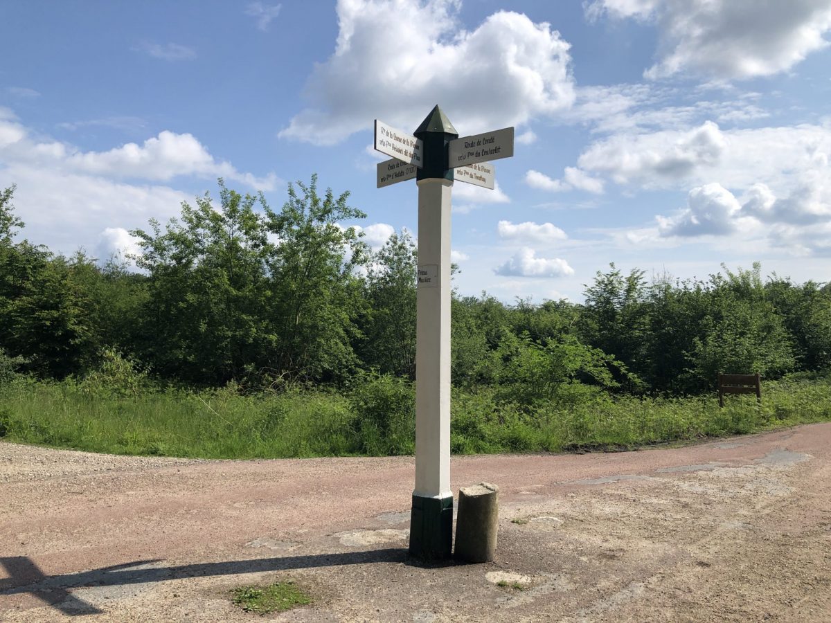
5-Poteau du Courcolet
La famille d’Auteuil est apparentée à celle des Condé depuis le XVIIème siècle, et les princes de Condé sont en charge de la capitainerie d’Halatte au moment de la création de cette route.
Le poteau du Courcolet, à l’intersection des routes d’Auteuil et de Condé, figure sur l’Etat des Forests de 1733 avec l’orthographe « court collet ».
These historic posts are maintained, renovated and preserved by the APTF (Association des Poteaux des Trois Forets) in the Chantilly, Halatte and Ermenonville forests.
The fourth milestone on the circuit is in the north-east part of the crossroads.
6-3-sided escutcheon, 2 coats of arms legible, the third too damaged
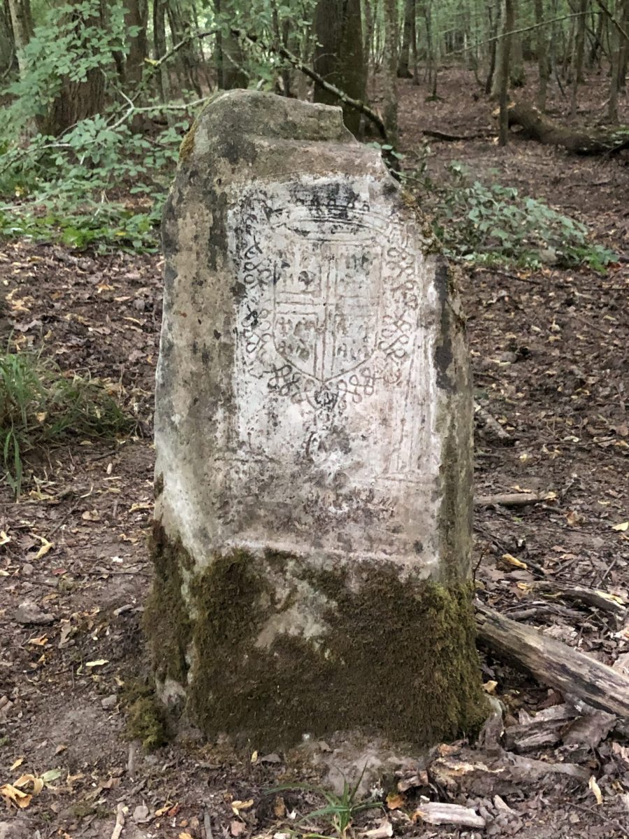
La borne est à la jonction des trois parcelles. On reconnait les armoiries du connétable de Montmorency et de l’évêché de Senlis. La troisième armoirie est celle de l’abbaye Saint-Vincent, mais trop abîmée pour être lisible. On la retrouvera sur les bornes suivantes.
Cette borne se situait à l’origine au milieu du carrefour du Courcolet, à l’intersection de la route de Condé et de la route d’Auteuil, ou, plus exactement, elle a vraisemblablement servi de point de repère pour le tracé de ces routes puis, une fois le carrefour créé, elle a été déplacée pour être remplacée par un poteau, plus visible de loin. Mise sur le côté du carrefour, elle a été mal repositionnée car le relief de la partie supérieure ne correspond plus aujourd’hui aux limites des anciennes parcelles forestières et est décalé d’environ 90°.
From the crossroads, take the route de Condé, heading south-east, the perpendicular to the right of the road you came from. The fifth milestone on the route is 160m along the right-hand side of the road, set into a tree.
7-2-sided escutcheon, 2 coats of arms
En bordure de la route de Condé, et facilement remarquée par les promeneurs, cette borne est emblématique de cet ensemble car elle est au 1/3 prise dans un chêne beaucoup plus jeune qu’elle. Elle est presque rectangulaire, avec un dessus plat, provenant apparemment d’un autre atelier de tailleurs.
La face sud présente les armoiries du connétable et la date de 1540. Sur la face nord, les armoiries de l’abbaye Saint Vincent de Senlis, abbaye royale fondée par Anne de Kiev, épouse d’Henri Ier, sont constituées de trois fleurs de lys, emblème de la royauté, et trois roses représentant les vertus théologales : foi, espérance et charité. Deux palmes, symbole des martyres, partent de la fleur de lys la plus en bas. L’écusson est traversé par la crosse de l’abbé encadrée des lettres S et V.
Continue along the route de Condé for 40m, the sixth milestone is on the left 20m up the path.
8-2-sided escutcheon, 2 coats of arms
Cette borne avait été déterrée et couchée sur le sol. Elle a fait l’objet d’une remise en place lors de la campagne de redressement des bornes en novembre 2023. Sa position a préalablement été defined by a surveyor en prenant en compte les autres bornes. On voit bien l’alignement de ces deux bornes qui sont visibles de l’une à l’autre.
Elle est très évasée vers le bas avec un sommet arrondi. Encore une nouvelle forme de borne d’un autre atelier de tailleurs de pierres.
Les armoiries du connétable de Montmorency et la date de 1540 sont sur la face sud, qui était contre terre et, de ce fait, remarquablement bien conservées. La face nord, partiellement cassée, présente les armoiries de l’abbaye Saint-Vincent.
Return to the route de Condé. 100m further on was a milestone, which was probably moved when roads were laid out in the seventeenth and eighteenth centuries, and whose face with the coat of arms of the Constable de Montmorency, which looks very similar to the previous milestone, is in the Musée de la Vènerie in Senlis, in the room on the Halatte forest.
Continue for another 260m to the Saint-Maurice crossroads.
9-Poteau Saint-Maurice
Le carrefour Saint-Maurice est à l’intersection de la route de Condé et de la route de la Queue de la Brosse. Il date du XVIIIème siècle et apparait sur la carte de 1724, en même temps que la route de Condé.
Le carrefour tire son nom des bois de Saint-Maurice sur lesquels il se trouve. Ces bois appartenaient au prieuré Saint-Maurice de Senlis, créé par Saint Louis en 1262, dans l’enceinte du palais royal.
Turn right onto the Queue de la Brosse road. The car park is 1,200m away.
END OF ROUTE
Download the pdf file of the tour: